Local News
After a month of extreme weather, large rain event looms this weekend
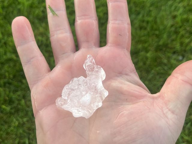
Last month was the fourth-warmest September on record for Steinbach. Scott Kehler is a meteorologist with Weatherlogics. He says it was an extreme month, with both highs and lows. September 4th had a record low, with the earliest single-digit high on record. The high was 8.3 degrees Celsius that day in Steinbach. Conversely, September 30th set a new daily record high of 29.3 degrees. As mentioned, last month was the fourth warmest September on record with a mean temperature of 16.0 degrees. "Interestingly, the warmest September on record was just last year in 2024," says Kehler. "And last September was actually quite a bit warmer than this one." September 2024 was the warmest on record, with a mean temperature of 17.9 degrees. According to Kehler, there has been a trend towards warmer Septembers in Southern Manitoba in recent years. "A lot of the warmest Septembers on record for Steinbach have happened in the last five years," he clarifies. "So, it does seem that our falls, at least lately, have been getting warmer." This week, we flipped the calendar to October, yet that did not stop our trend of extreme weather. On Wednesday, a severe thunderstorm rolled through Steinbach, dropping large hail. Kehler says golf ball-sized hail was reported, which is quite unusual for this time of year. "Because, in order to get hail of that size, you need quite an intense thunderstorm," he explains. "And usually the fuel for those storms, which is the heat and humidity, tends to drop off by the time you get this late into the year. But we had all the conditions just right, and we did get that golf ball-sized hail." Having said that, Kehler points out that Wednesday's hailstorm was not unprecedented. Even though Manitoba has received golf ball-sized hail in October before, he guesses this was a storm event that will be remembered for a long time. Meanwhile, Kehler says southeastern Manitoba could get walloped by rain this weekend. He notes Weatherlogics is forecasting at least 50 millimetres of rain for the region from Friday through Sunday. Kehler explains that a warm front will set up through southeastern Manitoba, and whenever you have that weather pattern, you have to be concerned about the potential for higher amounts of rain. "What will tend to happen is areas of rain or thunderstorms will form along that warm front and continue to pass over the same location again and again," he points out. Kehler says he does not expect extreme amounts of rain everywhere but suggests some pockets in the southeast could receive more than 100 millimetres, or four inches. According to Kehler, there will be a risk of localized thunderstorms on Friday and Saturday. He explains that it is those areas that will probably end up getting the highest rain totals from the weekend. And, as the storm system intensifies on Sunday, the rain will become a lot more widespread. "So, on Sunday, you can count on rains being steadier and for pretty much the entire southeast to get some pretty significant amounts," he adds.